
Exploring Environmental Controls on Coastal Dune Morphology using an Aeolian Surface Model: Insights from The Bahamas & Turks and Caicos Islands
Kat Wilson, Travis Swanson, David Mohrig
This project uses a morphodynamic model of aeolian sediment transport, modified from Swanson et al., 2016, to reconstruct the lithified coastal dune forms across The Bahamas and Turks and Caicos Islands. We tune variables to represent sediment supply, surface properties, and wind climate in order to interpret controls on variable dune forms across the region. We aim to unravel the coupled coastal processes of relative sea level rise during Holocene and Late-Pleistocene interglacial phases, carbonate sediment production during sea-level highstands, and wind- and wave-dominated transport.
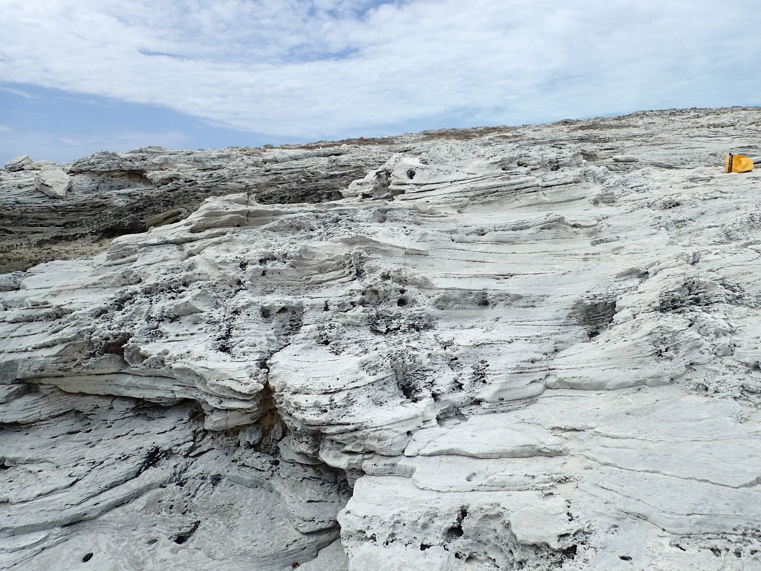
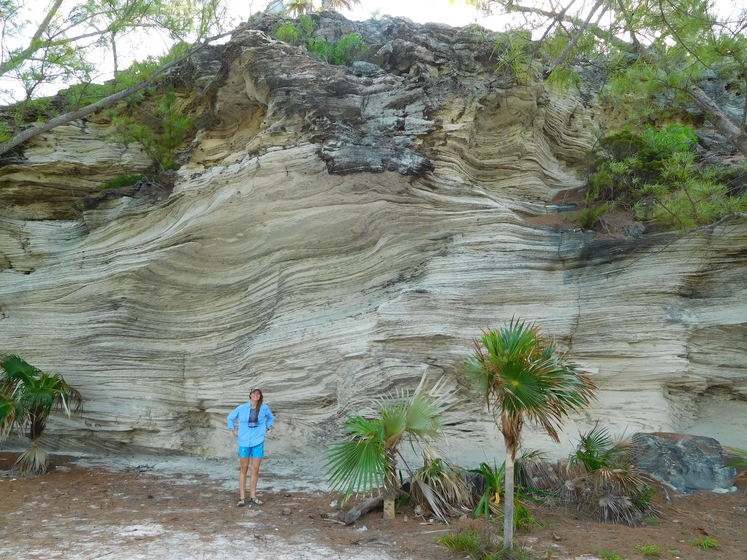
Observations of the internal dune stratigraphy and surface topography of preserved wind-blown dunes across The Bahamas and Turks and Caicos help us to parameterize the aeolian surface model.


The aeolian surface+stratigraphy model helps us to interpret the depositional environment and transport processes that constructed the wind-blown dunes across The Bahamas and Turks and Caicos.

Synthetic aeolian surface topography generated by the model

Synthetic aeolian stratigraphy generated by the model